I’ve been building an Android app for members of Radio Operators Cornwall (ROC) — it’s called RocLoc and it’s now available on Google Play for internal testers. If you don’t have a Google account, you can download the APK directly instead. Links above aren’t clickable in this summary — click Read more below to open the full post.
Callsign lookup — search any UK callsign to see the operator’s name, location, and licence details. Results are cached for offline use.
Sites and Pins — browse ROC operating sites and saved pins. Long-press any entry to see details including callsign, antenna height, and elevation.
Map view — all ROC sites and pins on an interactive map. Tap any marker to draw line-of-sight lines to all other stations in range — green for clear, red for blocked.
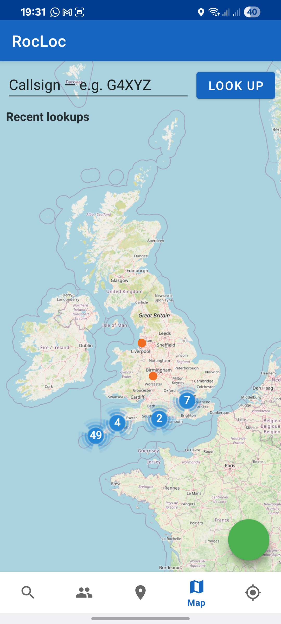
Map view with callsign lookup
Here — field planning — centres the map on your GPS position and draws LoS lines to every ROC site within range. Useful for scouting activation spots in the field. If terrain tiles are downloaded on WiFi before leaving it works with no phone signal.
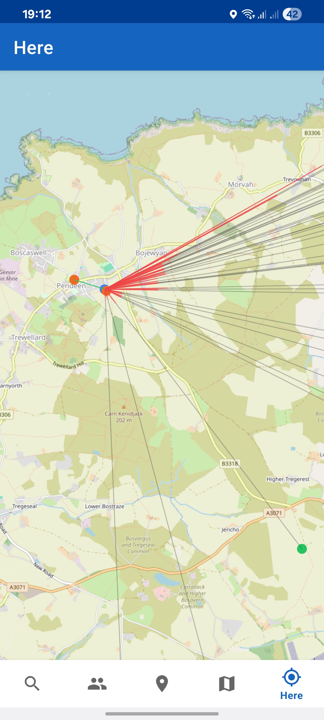
Here view from Pendeen — red lines blocked, green clear
On-device terrain — LoS uses OS Terrain 50 elevation data with atmospheric refraction. Download tiles in advance and it works with no phone signal.
Source is on GitHub. Report issues there.